Resilient Glendermackin Landscape Recovery
An ambitious multi-million 20-year landscape-scale project to improve protected sites, create and enhance habitats, reduce flood risk, improve water quality and mitigate against climate change.
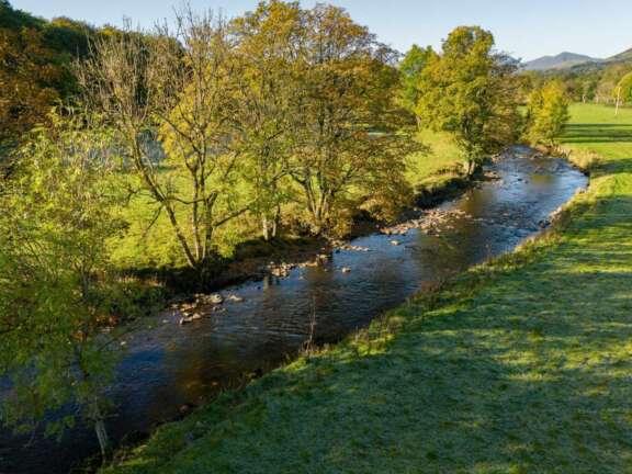
The Resilient Glenderamackin Landscape Recovery Project is an ambitious multi-million 20-year landscape-scale project that will work with 60 land managers across 43 holdings and 3 commons to improve the condition of protected sites, create and enhance wildlife friendly habitats, reduce flood risk to downstream communities, improve water quality and mitigate against climate change across the Glenderamackin catchment in the Lake District National Park.
The project will create a landscape that is much more resilient to the impacts of a changing climate, where its communities, farm businesses, and the natural environment have a sustainable future.
Project objectives are to:
- Improve the condition of seven protected sites within the project area.
- Improve the geomorphological processes of rivers in the project area, this includes providing an additional 800,000m3 of temporary water storage capacity in the catchment, upstream of Keswick, supporting reduced flood risk to the downstream communities.
- Restore and create over 7,700ha of terrestrial habitats, across a contiguous 142km2 catchment area and increase habitat connectivity whilst supporting sustainable, nature friendly farming. Habitats that will be restored and created include peatland, moorland, hedgerow, grassland, wetland and pond, river, woodland and riparian.
- Carry out habitat improvements for a range of target species including salmonids, bats and macro-invertebrates.
- Reduce the impact of invasive non-native species on the local environment.
- Reduce carbon emissions and sequester carbon within the project area.
- Strengthen the unique cultural heritage and historic environment within the catchment.
- Improve access to the project area for visitors, local and wider Cumbrian communities.
- Improve farm resilience to ensure farming in the catchment, and its associated social fabric remains viable into the future.
- Improve the flow of funding into nature recovery and trial blending of funding streams to deliver for people and the environment at scale.
- Educate, inspire and engage new and existing audiences.
- Improve the local economy through the delivery of the RGLR project.
The project builds on over a decade of work by West Cumbria Rivers Trust with land managers and partners in the catchment and is a response to the challenges experienced in the catchment - biodiversity loss, degraded habitats, drought risks and flooding.
Land managers have developed Land Management Plans with members of the West Cumbria Rivers Trust team. These plans have been informed by the needs of each farm business alongside the needs of the catchment. The individual plans and subsequent delivery will add up to the overall vision for the landscape across the project’s 20-year timeframe.
Main activities during project implementation will include managing the design, feasibility and consents process for some of the planned land use changes, habitat creation and restoration working with local contractors, farmers and land managers, creating opportunities for more people to connect with the local landscape through community and stakeholder engagement, partnership working to improve existing public access routes across the project area and monitoring and evaluation throughout the project’s lifetime to track whether the project is achieving what it has set out to do.
Project aims to commence delivery in 2027.
Who's involved:
West Cumbria Rivers Trust leads the Resilient Glenderamackin Landscape Recovery project with partners, The Rivers Trust and Nature Finance.
The project has been funded through its development phase by Defra’s Landscape Recovery programme and the project team worked with Defra, the Environment Agency and Natural England to develop its plans.
Learn more
Head over to the West Cumbria Rivers Trust website to learn more about the project.